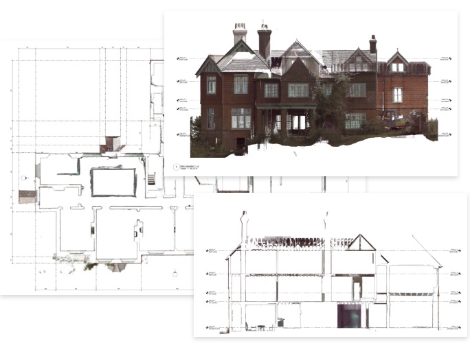
2D floorplans & elevations
From the LiDAR scan data slices we can produce highly accurate dimensioned floorpans and elevations. These can be supplied as DWG files to your architect, consultants or designers.
You could be looking to scan an existing property prior to development to create highly accurate dimensioned floorplans and elevations of existing an existing building or you could create a reality capture of project progress. Scanning a site also allows you to import the dimensioned data into AutoCAD or Revit for future adaptations and fit out.
Contact Us to book in a scan of your project
From the LiDAR scan data slices we can produce highly accurate dimensioned floorpans and elevations. These can be supplied as DWG files to your architect, consultants or designers.
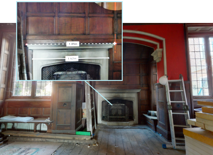
We can also supply the scanned point cloud data as a 3D AutoCAD or Revit model to your architects / consultants.
Contact us for a quote.
From the scan data we can also produce a "user friendly" flythrough model. This will allow designers and architects to revisit the site remotely, get their visual reminders of intricate building layouts and take measurements where required.
Please get in touch if you would like to discuss a full survey of your project.
Get in Touch